State Formed
April 30, 1802, an enabling act was
passed authorizing a constitutional convention, to form a state,
from which the following extracts pertinent to this subject are
taken:
''The inhabitants of the eastern
division of the territory northwest of the river Ohio, be, and
they are hereby authorized to form for themselves a constitution
and state government, and to assume such name as they shall deem
proper;
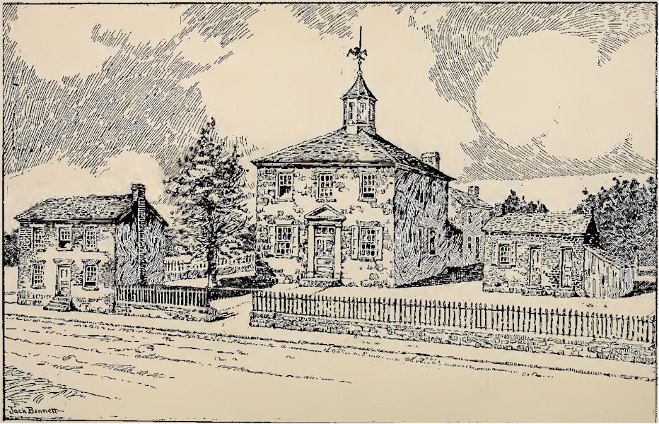
First Ohio Capitol
"That the said state shall consist of
all the territory included within the following boundaries,
to-wit : Bounded on the east by the Pennsylvania line; on the
south by the Ohio River, to the mouth of the Great Miami River;
on the west by the line drawn due north from the mouth of the
Great Miami aforesaid; and on the north by an east and west line
drawn through the southerly extreme of Lake Michigan, running
east, after intersecting the due north line aforesaid, from the
mouth of the Great Miami, until it shall intersect said Lake
Erie, or the territorial line, and thence, with the same,
through Lake Erie, to the Pennsylvania line aforesaid;
"That all that part of the territory of
the United States northwest of the river Ohio, heretofore
included in the eastern division of said territory, and not
included within the boundary herein prescribed for the said
state, is hereby attached to, and made a part of the Indiana
territory.
"That all male citizens of the United
States, who shall arrive at full age, and reside within the said
territory at least one year previous to the day of election, * *
* be, and they are hereby authorized to choose representatives
to form a convention, who shall be apportioned among the several
counties within the eastern division aforesaid, in a ratio of
one representative to every twelve hundred inhabitants of each
county * * * that is to say, from the county of Trumbull two
representatives, from the county of Jefferson seven, two of the
seven to be elected within what is now known by the county of
Belmont, taken from Jefferson and Washington Counties; from the
county of Washington four representatives; from the county of
Ross seven representatives, two of the seven to be elected in
what is now known by Fairfield County, taken from Ross and
Washington counties; from the county of Adams three
representatives ; from the county of Hamilton twelve
representatives, two of the twelve to be elected in what is now
known by Clermont County, taken entirely from Hamilton County;
and the elections for the representatives afore said, shall take
place on the second Tuesday of October next, the time fixed by
law * * * for elected representatives to the General Assembly.
''That the members of the convention * *
* when met shall first determine by a majority of the whole
number, whether it be or be not expedient at that time, to form
a constitution and state government for the people within the
said territory; and if it be determined to be expedient, the
convention shall be, and hereby are authorized to form a
constitution and state government; The Federalists, having been
defeated in their endeavor to have a small state formed, did not
cease their opposition to the proposed new state. Not having
been able to get what they wanted, they were now not in favor of
any change. As the act authorizing the calling of a convention,
left it to 'that body, when assembled, to say whether a state
would be formed, it became important for each side to elect as
many of its adherents to the convention, as possible. Political
excitement ran high. The Federalists complained of the
provisions of the enabling act prescribing the number of members
the different counties were allowed in the convention, claiming
that those which had adverse majorities to their party, were
given an unfair representation, in order to ensure a political
majority for the opposing party, and that Wayne county was left
out of the convention, because its vote would be opposed to the
new state. The Federalists endeavored to secure the election of
as many members, pledged in opposition to a state, as possible,
and hoped to defeat the project by a vote in the convention when
it had assembled. Notwithstanding their strenuous efforts, they
were sorely defeated. When the convention met, the vote upon the
question of statehood was thirty-four for it, to one against.
It is to be observed that the
convention, in forming the western boundary of the state,
followed the line that had been fixed by Congress in the
Enabling act of April 30, 1802, and which was the same as that
fixed in the proviso of the act of May 9, 1800, providing for
the division of the territory. The new boundaries for the state
set out in the convention of 1802 were as follows:
"Bounded on the east by the Pennsylvania
line, on the south by the Ohio River to the mouth of the Great
Miami River, on the west by a line drawn due north from the
mouth of the great Miami aforesaid, and on the north by an east
and west line drawn through the southerly extreme of Lake
Michigan, running east after intersecting the due north line
aforesaid, from the mouth of the Great Miami until it shall
intersect Lake Erie on the territorial line, and thence with the
same through Lake Erie to the Pennsylvania line aforesaid."
The contraction of the western boundary,
so that the state line began at the mouth of the Great Miami,
instead of at a point opposite the mouth of the Kentucky, gave
Indiana a strip of territory about fifty miles wide on the Ohio,
and one hundred miles long next to the eastern boundary of that
state, coming to a point near Fort Recovery, which happens to be
about in the due north line from the mouth of the Great Miami.
Disputes have arisen as to the
correctness of the surveys of the western and northern boundary
lines of the state, which have been fully set forth in former
issues of the Archaeological Reports published by this society.
Online Resources
|
Ohio AHGP

Source: Ohio Archaeological and
Historical Publications, Volume 5, John L. Trauger, 1898.
|